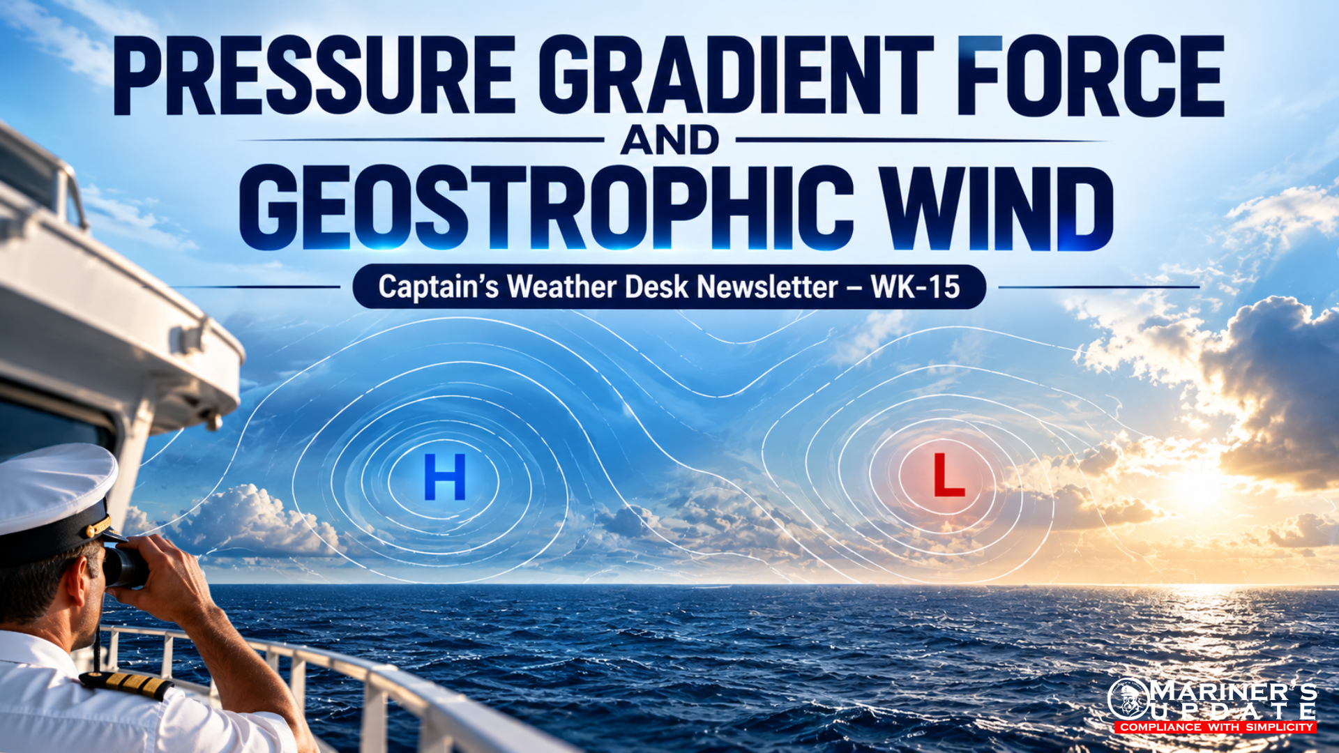
Understanding pressure gradients, isobars, Coriolis force and wind direction is essential for every navigator. A weather chart may show only a few lines and pressure values, but those lines provide valuable information about where the wind will come from, how strong it may be, and how pressure systems influence the weather at sea.
1. PRESSURE GRADIENT FORCE (PGF)
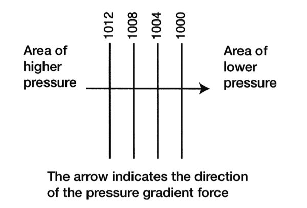
The Pressure Gradient Force (PGF) is the force responsible for initiating the movement of air in the atmosphere.
Atmospheric pressure is not the same everywhere. When there is a difference in pressure between two locations, air tends to move from the area of higher pressure towards the area of lower pressure.
The greater the difference in pressure over a given distance, the stronger the pressure gradient and, therefore, the stronger the force acting on the air.
How does PGF act?
On a weather chart, areas of equal atmospheric pressure are joined by lines called isobars.
The PGF acts:
From HIGH pressure → towards LOW pressure
and importantly:
PGF acts at right angles (90°) to the isobars.
This means that if you look at a chart and identify the direction from high pressure to low pressure, that direction represents the basic force trying to move the air.
Isobar spacing and wind strength
The distance between isobars provides an important indication of the pressure gradient.
Closely spaced isobars → steep pressure gradient → stronger PGF → stronger winds
Widely spaced isobars → weak pressure gradient → weaker PGF → lighter winds
Therefore, a Captain or navigator can make a quick assessment of the potential wind strength simply by examining the spacing of the isobars.
Remember: Isobars do not directly show wind direction. They show pressure distribution. The wind direction results from the combined effects of several forces.
2. GEOSTROPHIC WIND
The situation becomes more interesting higher in the atmosphere.
At approximately 600 metres (2,000 feet) or above, the influence of surface friction becomes relatively small. The air can therefore move more freely under the influence of the large-scale atmospheric forces.
Initially, the Pressure Gradient Force attempts to accelerate the air directly from high pressure towards low pressure.
However, because the Earth rotates, moving air is deflected by the Coriolis force.
PGF + Coriolis Force = Geostrophic Balance
As the air accelerates, the Coriolis force increases. Eventually, under ideal conditions, the Coriolis force balances the Pressure Gradient Force.
The resulting wind is called geostrophic wind.
In this condition:
Pressure Gradient Force → pushes the air towards LOW pressure
Coriolis Force → deflects the moving air
Balanced forces → wind flows approximately PARALLEL to the isobars
This is why, on upper-air weather charts, winds can often be considered to flow approximately parallel to the isobars.
Geostrophic Wind in the Northern Hemisphere
In the Northern Hemisphere, the Coriolis force deflects moving air towards the right of its direction of motion.
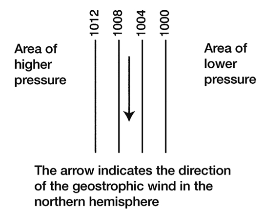
Consequently, when looking in the direction in which the geostrophic wind is blowing:
LOW pressure is on the RIGHT
HIGH pressure is on the LEFT
This relationship provides a useful practical method for estimating wind direction from a weather chart.
Wind speed and isobar spacing
The closer the isobars are together, the stronger the pressure gradient.
Therefore:
Close isobars → Strong pressure gradient → Stronger geostrophic wind
Wide isobars → Weak pressure gradient → Weaker geostrophic wind
This is particularly useful when assessing the potential strength of winds around deep depressions, intense low-pressure systems and strong pressure gradients.
3. BUYS BALLOT’S LAW
Buys Ballot’s Law provides a practical relationship between wind direction and the location of high- and low-pressure areas.
It is especially useful to the mariner when making a quick assessment of a weather situation.
Northern Hemisphere
If you face the wind, the area of LOW pressure will generally be on your right-hand side, while the area of HIGH pressure will generally be on your left-hand side.
An alternative way to remember the same relationship is:
In the Northern Hemisphere, stand with your back to the wind — LOW pressure is generally to your left.
This is a useful rule when interpreting surface weather charts, although actual surface winds are affected by friction and may not run exactly parallel to the isobars.
Southern Hemisphere
The Coriolis effect acts in the opposite sense in the Southern Hemisphere.
Therefore, the pressure relationship is reversed.
When facing the wind:
LOW pressure → generally on the LEFT
HIGH pressure → generally on the RIGHT
Thus, Buys Ballot’s Law must always be applied with consideration of which hemisphere the vessel is operating in.
4. WHAT HAPPENS NEAR THE EQUATOR?
Near the Equator, the effect of the Earth’s rotation on moving air becomes relatively weak because the Coriolis effect is very small.
As a result, the assumptions behind geostrophic flow and Buys Ballot’s Law become less reliable.
The wind may therefore cross the isobars more directly, moving more strongly under the influence of the pressure gradient force.
For navigators working in tropical and equatorial regions, this is an important limitation to remember.
5. GEOSTROPHIC WIND VS. SURFACE WIND
It is important not to confuse geostrophic wind with the actual wind experienced by a vessel at sea level.
Geostrophic wind is an idealised condition in which:
Surface friction is negligible.
The PGF and Coriolis force are approximately balanced.
Wind flows approximately parallel to the isobars.
Near the Earth’s surface, however, friction slows the wind.
As the wind speed decreases, the Coriolis force also becomes weaker. The PGF is then no longer completely balanced by the Coriolis force.
As a result, actual surface wind tends to:
Cross the isobars from HIGH pressure towards LOW pressure.
The angle at which the wind crosses the isobars depends on factors such as surface roughness, friction and atmospheric conditions.
Over the ocean, friction is generally less than over land, so the crossing angle is usually smaller.
6. HOW SHOULD A CAPTAIN READ ISOBARS?
When examining a synoptic weather chart, a simple sequence can be followed:
STEP 1 — Locate HIGH and LOW pressure
Identify the main pressure systems affecting the vessel’s route.
STEP 2 — Examine the isobar spacing
Look for areas where the isobars are tightly packed.
These areas indicate a strong pressure gradient and potentially stronger winds.
STEP 3 — Determine the hemisphere
The direction of Coriolis deflection depends on whether the vessel is in the Northern or Southern Hemisphere.
STEP 4 — Estimate the wind direction
Use the relationship between pressure systems, isobars and the Coriolis effect.
STEP 5 — Consider surface friction
Remember that the actual wind near sea level will not necessarily run exactly parallel to the isobars.
STEP 6 — Consider the vessel’s operational situation
Strong pressure gradients may indicate increasing wind, rougher seas and potentially deteriorating conditions, particularly around intense low-pressure systems.
MASTER’S TAKEAWAY
A weather chart is more than a collection of pressure numbers and lines.
The isobars show the pressure pattern.
The pressure gradient creates the initial force.
The Earth’s rotation deflects the moving air.
The balance between PGF and Coriolis force produces geostrophic flow.
Surface friction modifies the actual wind experienced by the vessel.
For the mariner, one simple principle is worth remembering:
“The closer the isobars, the stronger the pressure gradient — and generally, the stronger the wind.”
Learning to read the spacing and orientation of isobars gives the Captain an immediate visual understanding of the atmospheric situation and helps in making better decisions for route planning, heavy-weather avoidance and safe navigation.