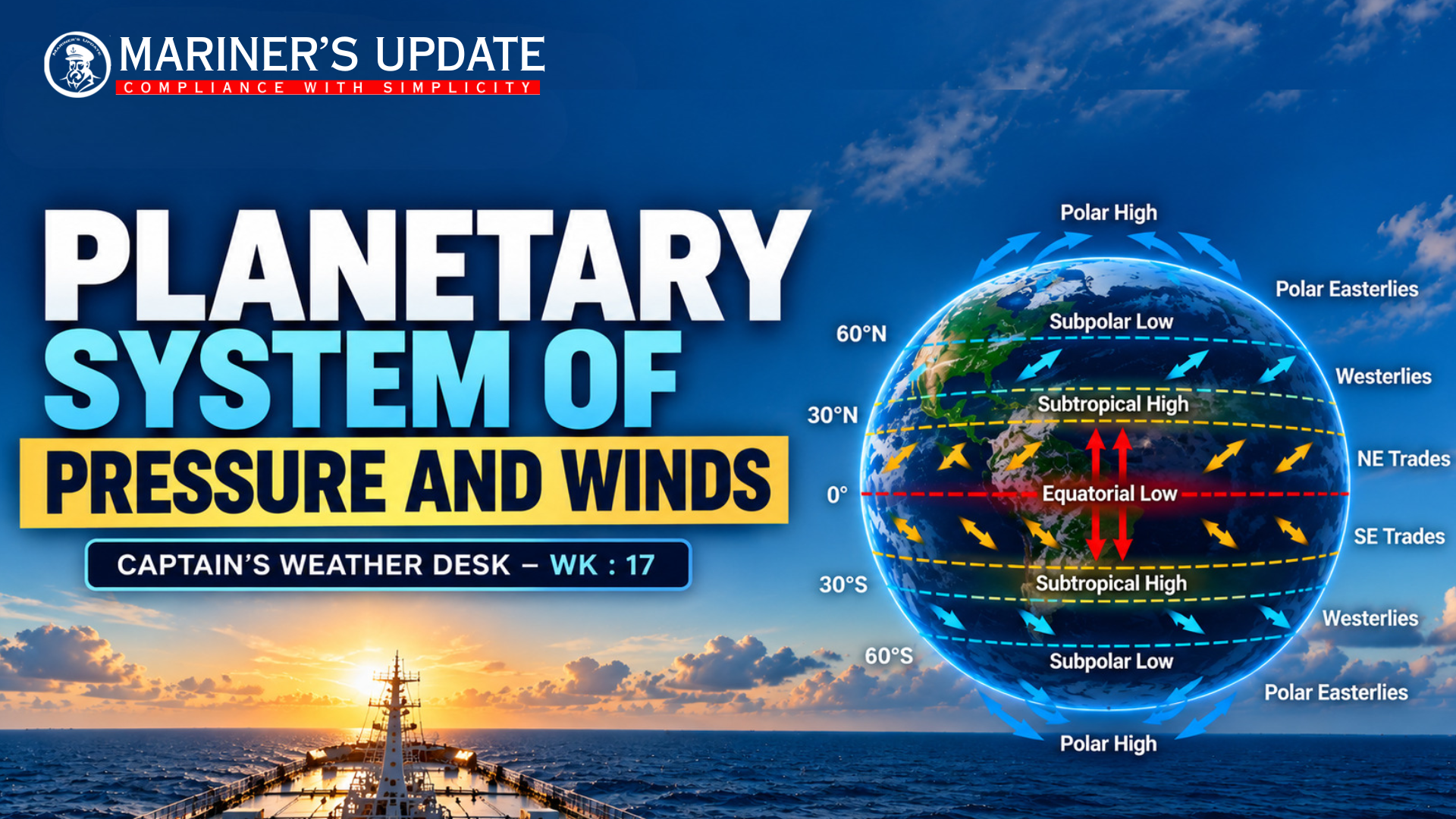
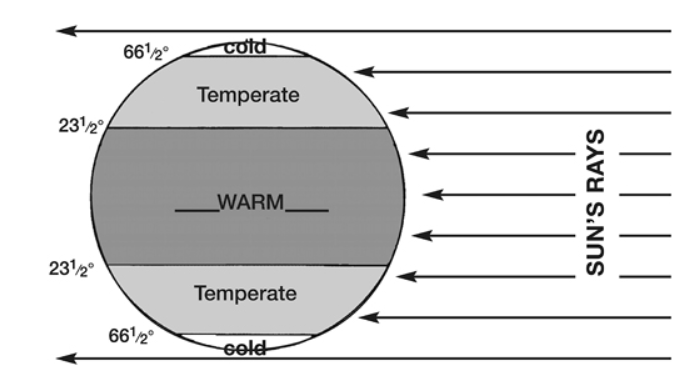
The Earth’s planetary wind system is mainly driven by the unequal heating of the Earth’s surface by the Sun.
The Sun’s rays are more direct in the tropical regions, so these areas receive greater heating. Towards the poles, the rays reach the surface at a much lower angle and the same solar energy is spread over a larger area. As a result, the tropics are generally warmer while the polar regions are much colder.
This difference in heating creates differences in air temperature, density and atmospheric pressure, which set the atmosphere in motion.
Idealised Pressure Distribution and Wind Circulation
To understand the global circulation, we can imagine an idealised Earth with a uniform surface, completely covered by water and without continents or mountains.
In this simplified situation, major pressure belts would develop around the globe.
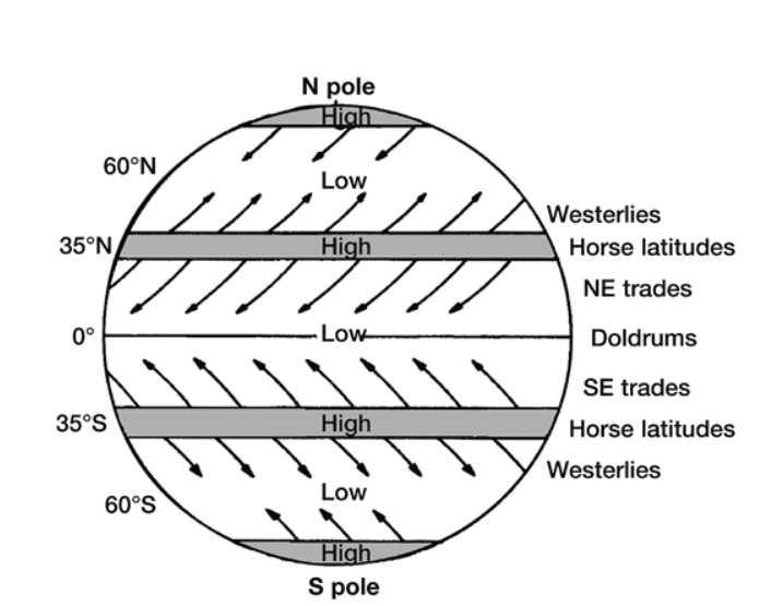
At the equator, strong solar heating warms the air near the surface. The warm air rises, producing a belt of low pressure. This region is associated with the Doldrums or Intertropical Convergence Zone (ITCZ), where the trade winds from both hemispheres converge.
Around 30° latitude, the air that has risen near the equator moves towards higher latitudes at altitude and eventually descends. This descending air creates the subtropical high-pressure belts, traditionally known as the Horse Latitudes.
Near the poles, intense cooling makes the air cold and dense. It sinks towards the surface and produces areas of high pressure. Surface air then flows away from these polar high-pressure regions.
Air naturally moves from high pressure towards low pressure. However, because the Earth rotates, the Coriolis effect deflects the moving air. This produces the characteristic planetary wind belts.
Main Planetary Wind Belts
From the equator towards the poles, the general pattern is:
Equator – Low Pressure / Doldrums
Warm air rises and the NE and SE trade winds converge in this region.
0°–30° – Trade Winds
Air moves from the subtropical high-pressure belts towards the equatorial low. Due to the Coriolis effect, they become the NE Trade Winds in the Northern Hemisphere and SE Trade Winds in the Southern Hemisphere.
Around 30° – Subtropical High / Horse Latitudes
Descending air produces relatively high pressure and generally stable atmospheric conditions.
30°–60° – Westerlies
Air moving towards higher latitudes is deflected by the Coriolis effect, producing prevailing westerly winds. This belt is particularly important for the movement of mid-latitude depressions and frontal systems.
Around 60° – Subpolar Low
The westerlies and polar easterlies converge, encouraging air to rise and contributing to frequent frontal activity.
60°–90° – Polar Easterlies
Cold air flows away from the polar high-pressure regions and is deflected to produce the prevailing polar easterlies.
This circulation is commonly represented by three atmospheric circulation cells in each hemisphere: the Hadley Cell, Ferrel Cell and Polar Cell.
The Real Atmosphere
The pattern described above is an idealised model. In reality, the distribution of pressure and winds is modified by continents, oceans, mountains, ocean currents and seasonal changes in solar heating.
The modification is particularly significant in the Northern Hemisphere because it has a much larger land area. The Southern Hemisphere, with its greater ocean coverage, generally follows the idealised planetary circulation more closely.
Seasonal movement of the pressure belts also plays an important role in weather patterns such as the monsoon circulation and seasonal movement of the ITCZ.
Why It Matters to Mariners
For mariners, understanding planetary pressure and wind circulation provides the foundation for interpreting large-scale weather conditions during ocean passages.
It helps explain why certain areas are associated with persistent trade winds, why the ITCZ experiences frequent convection and thunderstorms, why subtropical regions can have lighter and more stable winds, and why the westerly belt is associated with moving depressions and frontal systems.
The basic relationship can be remembered as:
Unequal solar heating → temperature differences → pressure differences → movement of air → planetary wind circulation.
Understanding this basic pattern makes it easier to interpret weather charts, pressure systems and prevailing winds encountered during a voyage.
#MaritimeMeteorology #MarineWeather #Seafarers #MerchantNavy #WeatherRouting #MarineNavigation #MasterMariner #MarinersUpdate